4:08 p.m.
The Arkansas River at Toad Suck crested Tuesday at 285.4 feet, as measured from sea level, and has gone down 18 inches since then, but the water level at Craig D. Campbell Lake Conway Reservoir continues to rise, said Faulkner County judge Jim Baker.
“We expect it to rise another foot to 15 inches,” Baker said.
The river is starting to slow down and recede in Conway, but the problems on the lake still reside, according to Keith Stephens with the Arkansas Game and Fish Commission.
“It won’t change until the levels are equal on both sides of the dam,” Stephens said. “Hopefully it will start to stabilize soon.”
Lake Conway’s water was almost 4.5 feet above normal pool as of Thursday afternoon and was still rising.
“We are starting to see a slight reduction in how fast it is rising,” Stephens said. “ It is currently rising about one foot every 30 hours.”
There was not as much of a rise in Palarm Creek over the past two days and the reduction in elevation between the creek and the lake is causing the decrease in rate of rise in the lake, Arkansas Game and Fish officials said.
“As that gap closes, we will continue to see a reduction in how fast the lake rises,” Stephens said. “The Arkansas River is falling out some, but we need it to get down to around 283 ft. MSL or below, at the Toad Suck Lock and Dam, to impact how much higher Lake Conway will rise due to inflow from Palarm Creek. Hopefully that will happen within the next 24 hours.”
The area is still expected to get between 1 to 2 inches of rain by Saturday, which could cause complications, Stephens said.
“Because the lake is so high and main tributaries are already backed up, any significant rainfall could cause flash flooding in the creeks and increase the lake's water level,” Stephens said. “Given current forecasts and conditions, it looks like the lake could rise another foot by tomorrow afternoon if conditions do not change dramatically. This would put the lake close to 5.5 ft above normal pool, the highest lake level recorded since the lake was created almost 70 years ago.”
Officials with Arkansas Game and Fish said they are hoping to see some changes in Palarm Creek tomorrow and hopefully be able to predict the lake's crest within the next day or two, barring any significant rain.
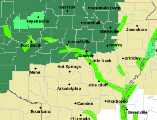
In Northwest Arkansas, the National Weather Service issued a flood advisory in Washington County. A flash flood watch was already in effect throughout the area.
— Stephen Simpson
12:18 p.m.
Weather officials issued a flash flood watch across much of northern Arkansas Thursday ahead of heavy rains expected to fall throughout the day and into Friday morning.
Forecasters said they expect up to four inches of rain to fall in the area starting at around 1 p.m. Thursday, which could see flash flooding at smaller rivers as thunderstorms move into the area.
The weather agency said the risk for damaging weather is limited.
The affected area stretched across Northwest Arkansas and some of the central part of the state, as far south as Scott County and as far east as White, Independence and Sharp counties.
Heather Cross, a meteorologist for the weather agency, said forecasters are watching how the heavy rain might impact the Arkansas River, which has reached historic heights and caused damaging flooding this past week.
“We’ve seen so much rain here recently, on top of river flooding, so it’s a sensitive situation,” Cross said.
Recent heavy rains in Oklahoma filled up lakes there, and the Army Corps of Engineers is releasing water from a dam near Tulsa into the Arkansas River. The surge of water raised river levels to historic heights and has led to hundreds of homes being evacuated.
The river in Little Rock reached its highest expected point this week and officials noted that levels are falling.
But with more rains, weather officials worry it might worsen areas that are already flooded or prolong water levels in the river.
Cross said the incoming storms will likely see water pool up in areas prone to flash flooding, including around the Buffalo River and other small waterways.
Little Rock is outside of the flood watch area but continued to be under a flood warning Thursday morning.
Cross said early forecasts show drier and cooler weather starting next week as a cold front moves into Arkansas.
—Youssef Rddad