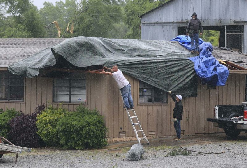
High winds and heavy rain downed trees Thursday across central Arkansas, knocking out power to more than 9,000 electrical customers, flooding roads and overturning vehicles, authorities said.
National Weather Service meteorologists issued tornado warnings for parts of several counties around 1 p.m. Thursday, citing 60 to 70-mph winds. There were no serious injuries reported from the storm, officials said.
National Weather Service meteorologist Heather Cross said the combination of wind and severe thunderstorms produced a rotating storm system that spawned several suspected tornadoes as it crossed central Arkansas.
By 5 p.m., only one tornado had been confirmed, Cross said. It touched down in the Jacksonville-Cato area, where Pulaski County sheriff's office spokesman Lt. Cody Burk reported multiple trees had fallen onto houses and across power lines.
Cross said more tornadoes likely would be confirmed and rated throughout the evening Thursday, because scouts were still out assessing damage as of 5:30 p.m.
High winds overturned at least three 18-wheelers in the vicinity of Interstate 30 and Interstate 430 near the Diesel Driving Academy's Little Rock training campus. The three trucks were in the parking lot and tow-truck operators were at the scene by 2:30 p.m. Thursday.
Little Rock Police Department spokesman officer Eric Barnes also said a sign blew into a car in that same area, crashing through the window and slightly injuring the driver. Barnes said he didn't know the exact location of that incident Thursday afternoon.
At the height of the storm, Entergy spokesman Kerri Case said about 9,500 customers were without power, though that number had dropped to 4,800 by 5 p.m. The majority of the electrical failures were in Pulaski County, Case said.
"We understand that being without power at any time is inconvenient and we're sorry for that, but our guys are working as quickly as is safely possible," Case said.
Case said Entergy's power failures were concentrated north of North Little Rock near Jacksonville.
"When you have high winds like that with saturated ground, you'll get limbs down, whole trees down," Case said.
"There's a lot of things we have been able to speed up, but it takes about six hours to set a new pole no matter what."
Case said Entergy workers were still assessing the extent of the damage in many areas as of 4 p.m.
North Little Rock Electric had about 130 failures at 5 p.m. Thursday, primarily north of Sherwood.

Burk said downed trees and power lines were reported in the northern portion of the county, and 10 additional deputies were called in to help with traffic and cleanup Thursday night.
High water prompted officials to barricade 13 roads across the county, Pulaski County communications director Cozetta Jones said, though some had reopened as early as 4:30 p.m. Thursday.
"We barricade them usually because they have water running over the road," Jones said. "We don't want anyone to go through that area."
Five streets were still flooded countywide at 4:30 p.m. Thursday, and Jones said whether the water would drain off quickly enough to reopen roads overnight depended on the area.
Barnes said officers barricaded the Sibley Hole and Baseline roads intersection Thursday afternoon after a large amount of debris fell into the roadway.
Cross said 1-2 inches of rain fell in central Arkansas in a little more than an hour. Water falling so quickly is a primary cause of flooding, she said.
Capt. Jason Weaver with the Little Rock Fire Department said crews responded to numerous water rescues and reports of downed trees and power lines throughout the day.
"Our guys were running like crazy, but it was otherwise pretty uneventful," Weaver said.
Cross said central Arkansas likely will continue to see heavy rainfall for the next seven days as more thunderstorms move through.
The National Weather Service's seven-day forecast predicts thunderstorms today, Saturday, Tuesday, Wednesday and Thursday.
Metro on 05/03/2019