FORT SMITH -- Three storms that produced four confirmed tornadoes left Arkansas fairly unscathed Monday, but more severe weather is possible across the River Valley and Northwest Arkansas through this afternoon.
The National Weather Service in Tulsa, Okla., reported there was a slight risk of severe storms for all of eastern Oklahoma and Northwest Arkansas by late Tuesday afternoon. The affected counties in Arkansas include Sebastian, Crawford, Washington, Benton and Carroll counties.
The National Weather Service confirmed four EF-1 tornadoes touched down in the state after investigating Tuesday, said John Lewis of the National Weather Service in North Little Rock.
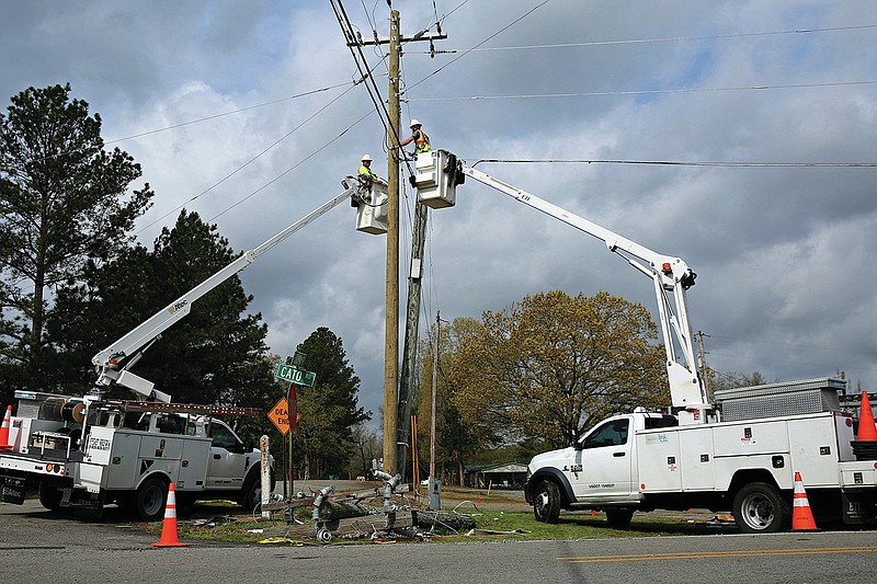
A tornado near Bloomer in Sebastian County tracked for about a mile, he said. Another near Charleston in Franklin County tracked about 2½ miles. It was unclear how far a third near Scranton tracked and a fourth between Cato and Little Rock Air Force Base in Faulkner County.
All of the tornadoes caused minimal damage to homes and barns, Lewis said.
An EF-1 tornado is the second-weakest tornado on the Enhanced Fujita Scale. Winds for an EF-0 and EF-1 reach between 65 mph to 110 mph.
Investigators were unable to reach all of the path for the tornado in Faulkner County because of trees down, Lewis said.
Logan County Sheriff Jason W. Massey said there was damage to barns, homes and trees along the tornadoes' path near Scranton. He said the damage appears to follow a straight line.
Massey said all three of the storms moved through different parts of the county, which caused some intense moments for officials.
"It was a dramatic moment," Massey said. "We definitely feel we got out much better than we were anticipating. That we know of, there was no one injured."
Even those stationed at National Weather Service headquarters in North Little Rock had to break for a moment to be certain they were safe.
"We knew it was close, but not really close enough to shelter," Lewis said.
Lewis said his team made a call to Memphis to put them on standby to take over for the Little Rock office if the storm moved closer.
"We never fully turned it over to Memphis," Lewis said.
Lewis said he remembers only a handful of times during his career at the North Little Rock office that forecasters have needed to take shelter. He's worked at the office since 1994.
"The time that I remember the most was in 2008," Lewis said. "We had a storm come in through the southwest. It was producing tornadoes occasionally, and two forecasters came in from outside and their eyes were great big."
Lewis said about that time those in the office could hear a roar in the background and the walls started shaking. Memphis was called, and the staff took shelter in a safe room in the building.
Kendall Beam, Sebastian County Emergency Management director, said about 6:15 p.m. Monday the county had seen heavy wind, with a "tornado rotation" having gone over the county's Emergency Operations Center at 8400 S. Zero St. in Fort Smith.
Golf ball-sized hail was also reported in Fort Smith, although there were reports of larger-sized hail out in the county. This included baseball-sized hail in Lavaca, which resulted in damage to vehicles.
According to the power outage map on Oklahoma Gas & Electric's website, roughly 2,305 customers experienced power outages due to the severe weather. The outages on Monday were from Lavaca to Scranton. As of Tuesday afternoon 600 Arkansas Valley Electric Cooperative customers were without power in Crawford County, 124 in Franklin County and 24 in Johnson County. There were also 18 Southwestern Electric Power Co. customers without power Tuesday afternoon.
Several Arkansas counties including Crawford, Franklin and Sebastian were under a tornado warning Monday from 4 p.m. to 5 p.m. and remained under a tornado watch until 11 p.m.
The National Weather Service stated that severe thunderstorms across Eastern Oklahoma to west central and Northwest Arkansas remained possible Tuesday afternoon through Wednesday morning. A weather alert stated that any storm that develops has the potential for hail, damaging winds and tornadoes.
The National Weather Service added that the severe weather threat should clear by early to midafternoon today, with another storm likely this weekend.
Faulkner County officials were thankful the storm didn't cause extensive damage, despite radar picking up a large amount of velocity over the county between Mayflower and Cato as the storm passed.
County Judge Jim Baker said he couldn't find any signs of a tornado from the damage he surveyed. He said winds and hail caused minor damage for residents.
Baker said at least one vehicle was totaled by the hail that reached golf ball sizes in the county.
Lewis said hail had the most significant impact Monday, with some areas reporting up to softball-sized hail.
Even some flash flooding throughout the state could have been caused by the hail, Lewis said. He said hail could have clogged drainage systems.
Bobby M. Kelly III, a spokesman for Conway, said the city saw flash flooding in areas like downtown, which often has trouble with flooding. Flooding south of the city was a little more unusual, he said.
"Some parts of the city saw a 50- to 100-year amount of rainfall in about 20 minutes," Kelly said. "It simply overloaded our capacity to move water.
"I don't know if there is a way we could engineer our way out of that."
Kelly said it's possible that the hail caused problems for drainage.
The city was going to try to combat water getting into businesses downtown by closing off certain streets Tuesday night, in anticipation of more rainfall today. He said the wake from vehicles driving through downtown can cause more issues for business owners.
City officials are working on long-term solutions to combat downtown flooding, Kelly said, but it won't be completely changed overnight.
 Tracy Neal, with the Faulkner County Road Department, uses a chainsaw to remove debris from Adams Lake Rd. near Conway on Tuesday, April 12, 2022 after a severe storm system moved through the area. (Arkansas Democrat-Gazette/Colin Murphey)