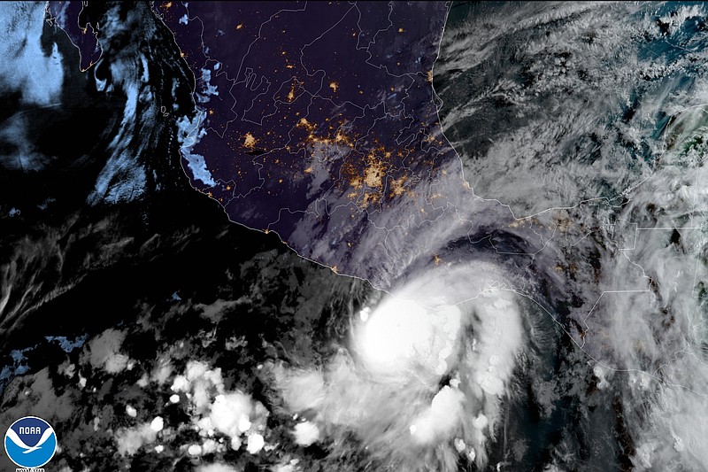
MEXICO CITY -- Agatha, the strongest hurricane on record to make landfall in May in the eastern Pacific, swept ashore on a stretch of tourist beaches and fishing towns in southern Mexico on Monday.
Torrential rains and howling winds whipped palm trees and drove tourists and residents into shelters.
Oaxaca state's civil defense agency showed families hustling into a shelter in Pochutla and a rock and mud slide that blocked the highway between that town and the state capital.
Agatha made landfall about 5 miles west of Puerto Angel as a strong Category 2 storm, with maximum sustained winds of 105 mph. But it quickly began losing strength as it moved inland.
By evening, maximum sustained winds fell to 80 mph. It was moving northeast at 8 mph, heading toward the Gulf of Mexico, where its remnants might re-emerge.
Near Puerto Angel, gusts of wind, heavy rain and big waves began lashing the beach town of Zipolite, long known for its clothing-optional beach and bohemian vibe.
"There is a lot of rain and sudden gusts of strong wind," said Silvia Ranfagni, manager of Zipolite's Casa Kalmar hotel. "The ocean is really stirred up, and it's raining a lot," said Ranfagni, who decided to ride out Agatha at the property. "You can hear the wind howling."
National emergency officials said they had assembled a task force of more than 9,300 people for the area and more than 200 shelters were opened as forecasters warned of dangerous storm surge and flooding from heavy rains.
After forming Sunday, Agatha became the strongest hurricane on record to make landfall in May in the eastern Pacific, said Jeff Masters, meteorologist with Yale Climate Connections and the founder of Weather Underground.
He said the region's hurricanes typically get their start from tropical waves coming off the coast of Africa.
"Since the African monsoon typically does not start producing tropical waves until early or mid-May, there simply aren't enough initial disturbances to get many eastern Pacific hurricanes in May," Masters said. "In addition, May water temperatures are cooler than they are at the peak of the season, and wind shear is typically higher."
Masters was not sure if Agatha was kicked off by a tropical wave -- areas of low pressure that move across the tropics -- but the storm has benefited from warm waters and low wind shear.
Late Monday morning, Agatha accelerated slightly as it moved toward the area near Puerto Escondido and Puerto Angel in the southern state of Oaxaca. The region includes the laid-back tourist resorts of Huatulco and Mazunte in addition to Zipolite.
The hurricane center said Agatha could "bring an extremely dangerous storm surge and life-threatening winds."
It said the storm was expected to drop 10 to 16 inches of rain on parts of Oaxaca, with isolated maximums of 20 inches, posing the threat of flash floods and mudslides.
In Huatulco, municipal authorities canceled school and ordered "the absolute closure" of all beaches and its seven bays, many of which are reachable only by boat.
The government's Mexican Turtle Center in Mazunte announced it was closed until further notice.