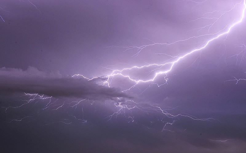
Severe storms and a high possibility of strong and long-tracked tornadoes are predicted for much of Arkansas Thursday, forecasters said.
The lower two-thirds of Arkansas is at an enhanced risk of severe weather, according to a Tuesday briefing from the National Weather Service.
An enhanced risk is defined by the weather service as several severe storms that will produce very large hail, damaging winds and/or tornadoes, a tweet from the service said.
“A concerning amount of instability and wind energy will fuel more numerous severe storms on Thursday and Thursday night,” the briefing said.
“The storm system moving in Thursday night has a higher potential for severe weather than we’ve seen in some time,” said Travis Shelton, a meteorologist with the National Weather Service in North Little Rock.
Storms on Thursday are predicted to have hail as big as baseballs, 80 mph winds or stronger and a high potential for tornadoes, Shelton said on Tuesday.
He said the storms will likely last until early Friday morning, with some rain possibly lingering into Friday.
The northern third of the state is at a marginal or slight risk for severe weather, meaning storms could still produce hail but it will be smaller and tornadoes are less likely, the weather service said.
Wednesday is also forecast to have scattered severe storms and a marginal or slight chance of severe weather for most of the state, Shelton said.
The tornado potential for Wednesday is very low, the briefing said. Winds could be as strong 60 mph and hail could be as big as a quarter.
“In addition to severe weather, several inches of rain are likely Wednesday through Thursday night. With the ground saturated in many areas, flash flooding is expected,” the briefing said.
Meteorologists said that ongoing river flooding, especially in the White River Basin, will worsen and other basins could experience new river flooding.
Shelton said that Little Rock could see up to half an inch of rain on Wednesday and anywhere between two to three inches on Thursday.
“There could be even more than that if strong storms move over the same place,” Shelton said.
The forecaster said that Arkansas drivers should be careful when driving on roads covered by water.
“Sometimes drivers are confident and think they know what they road looks like, but once water is covering it you can’t know the road is still there,” Shelton said.
Matt Ramsey, a spokesman for Entergy, said that the electrical company is always “storm ready” and is watching the weather and planning to react.
“The weather is a funny thing and hard to predict but with as much wind and possibly tornadoes are involved they could knock tree limbs into lines and power poles and there could be outages,” Ramsey said.
He said crews were not allowed in bucket trucks to fix lines if winds were stronger than 25 to 30 mph.
“Once it is safe, we will have crews out there to fix any damage,” Ramsey said.
Both Ramsey and Shelton said that they’d recommend Arkansans preparing by getting a first aid kit with medical supplies, nonperishable food, a charged cell phone and water.
“Make sure you have a shelter or a place to go that’s secure in case severe weather is in your area” Shelton said, “And make sure you have a way to receive weather alerts, whether that is your cell phone, television or weather radio.”
Shelton said some changes could be made to the forecast closer to Thursday and he encourages people check for updates frequently.