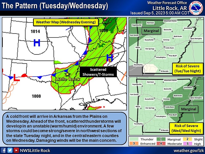
Isolated storms with heavy rainfall and damaging winds are possible in parts of the state on Tuesday and Wednesday, the National Weather Service said. Intense heat is set to return to most of Arkansas on Wednesday.
The storms on Tuesday through Tuesday night will be contained mostly to the northwest corner of the state, said Dan Koch, a meteorologist with the weather service in North Little Rock.
The corner extends from Fort Smith to Mountain Home, including Fayetteville and Harrison.
“There is a marginal risk of isolated storms in Northwest Arkansas, meaning there is a possibility but it is not widespread,” Koch said Tuesday morning.
A marginal risk is defined by the weather service as “An area of severe storms of either limited organization and longevity, or very low coverage and marginal intensity.”
Isolated showers could produce some heavy rainfall but the main concern is damaging winds, the forecaster said.
“The chance for hail is low and the chance for a tornado is practically null,” Koch said.
As Tuesday night ends, high heat index values are set to return to the state on Wednesday, the weather service said.
“As those storms overnight clear out, it will give way to brutal heat tomorrow,” Koch said.
Forecasts show that central Arkansas could see a heat index value of over 105 degrees and southern parts of the state could see values closer to 110 degrees, the meteorologist said.
“This is typically what we see in September,” Koch said, “We see this resurgence of intense heat. Hopefully, this is the last big push of this really hot and uncomfortable weather.”
“This is the same old heat we’ve seen all summer, year after year. I can’t promise we won’t get a few hot days later in the month, but as for this week, Wednesday is the only day forecast to be this uncomfortable,” the meteorologist said.
He said that the National Weather Service is watching the temperatures and will issue a heat advisory if necessary.
On Wednesday, the stormy pattern returns and parts of eastern and Central Arkansas have a marginal chance of severe weather.
Little Rock, Pine Bluff, Jonesboro, Bald Knob and West Memphis could see isolated storms that produce heavy rain and strong winds, the weather service said.
“What we really expect in those areas on Wednesday is an isolated storm that might need a warning issued,” Koch said.
He said that it is not unusual to see some severe weather during September.
“We get a little taste of the stormier pattern with a storm or two, we see more as we enter into October to November, where we see more storms as the seasonal battle of heat and cold move around,” he said.
BURN BANS
Over 30 counties in Arkansas have burn ban in effect, as of Tuesday just before noon, according to a map from the Arkansas Department of Agriculture.
Most of the counties are in the southern half of the state and parts of western and eastern Arkansas.
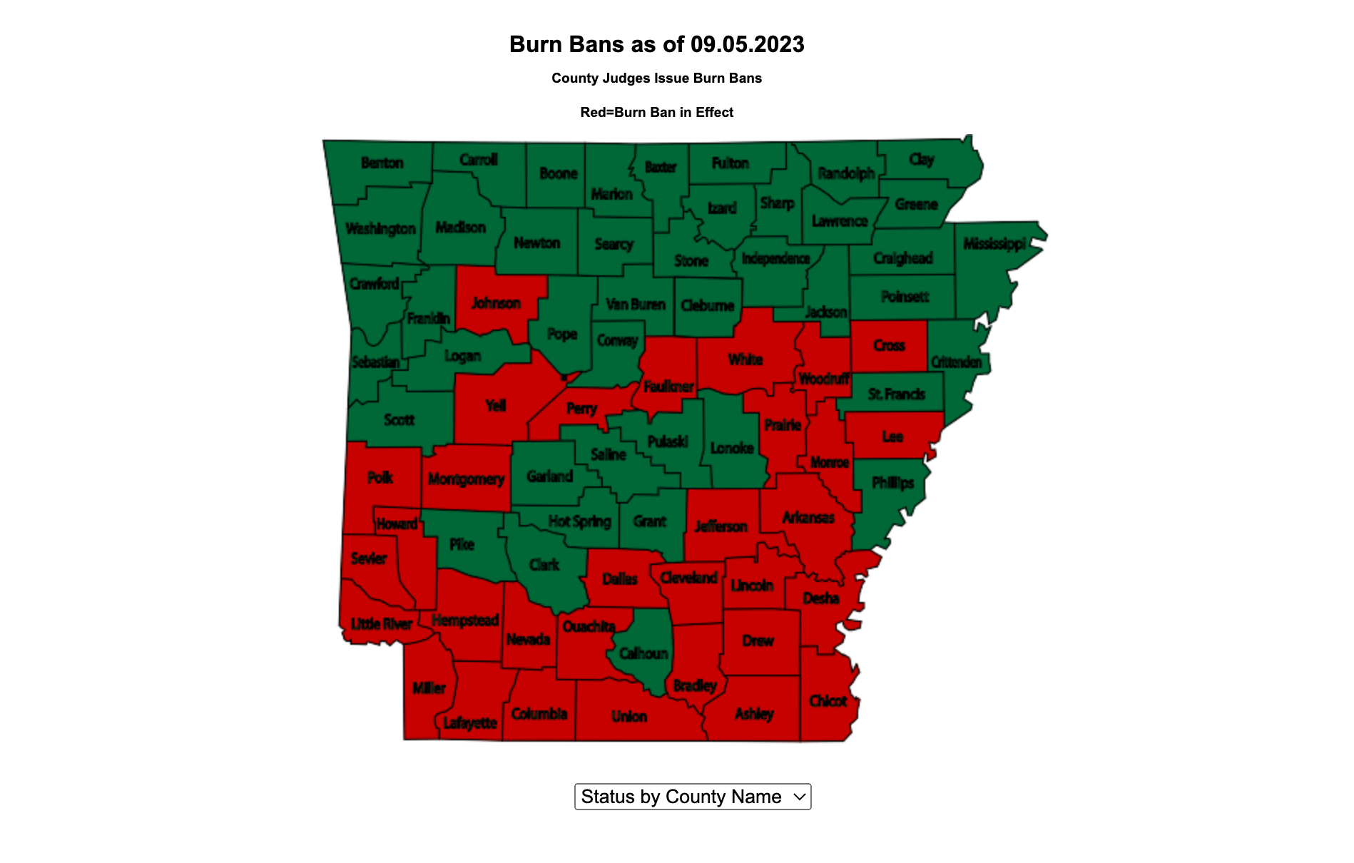 This map shows the Arkansas counties that have a burn ban in effect as of Tuesday, September 5, 2023, according to the Arkansas Department of Agriculture. (Arkansas Department of Agriculture)