Northern parts of the state have a couple of chances to see snow this week through the weekend, while parts of central Arkansas, including Little Rock, are more likely to see some rain and cool temperatures, the National Weather Service said.
The weather service said in an online forecast issued Monday that several storm systems moving through the region the next seven days could bring rain and some chance of snow to Arkansas.
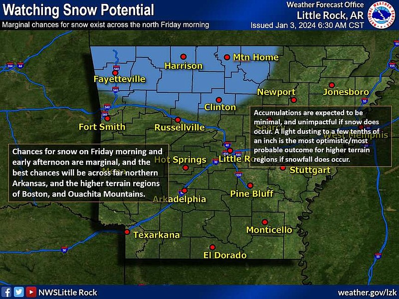
The first system that could bring snow to northern parts of Arkansas is set to enter the state sometime late Thursday or early Friday, said Dylan Cooper, a meteorologist with the National Weather Service office in North Little Rock.
The best chances for snow will be in the higher terrain areas on Friday morning, and minimal accumulations, if any, are expected, a post on X from the weather service said Wednesday morning. The chances for snow are marginal.
Cities forecast to possibly see snow at the end of the week include Fayetteville, Mountain Home, Harrison and Clinton, the weather service said.
"This is our weaker system coming through and while we're looking out for it, we aren't expecting any sort of impacts," Cooper said Wednesday morning.
Temperatures through the end of the week statewide could see lows in the upper 20s, he said.
"Little Rock will likely have a no snow weekend. It will likely be exclusively rain," Cooper said. "Maybe we could see some flakes fall but I can tell you that there's high confidence that we won't see anything accumulate."
The rain will move into the metro area on Friday afternoon and should be out of the area before dawn on Saturday, the forecaster said.
"In Central Arkansas, maybe bring an umbrella and jacket, it will still be fairly chilly but not enough for snow," Cooper said.
The forecaster said there was not a concern for severe weather or flash flooding with the system as of Wednesday morning.
"Little Rock will see half an inch of rain or less," he said.
The second chance parts of Arkansas have to see snow is forecast for early next week, the forecaster said. That system is the more energetic of the two.
Cooper said that since that time frame is still far out, there is less confidence.
"Essentially, places north of us might see some snow and this is a situation where we are tracking to see how far the snow could come down," he said.
Colder air may be coming to much of the state later on, Cooper said.
"There are indications of a surge of Arctic air by the middle of the month," the weather service said.
"Speaking in generalities here, the reason we haven't seen cold air, and I'm talking real cold winter air, is because the Arctic air blocked way up north. There is some data indicating that the arctic air may get displaced and could ooze down to the plains in the middle of the month," Cooper said.
He said the time frame was too far out to suggest any temperature ranges the state might see with Arctic air as of Tuesday morning.
"The data has consistently trended toward a cold air mass moving in. We're not sure if or how much colder than normal temperatures we would really see. But there's still lots of bugs to work out," Cooper said.