The National Weather Service said Tuesday that much of Arkansas will remain under a wind chill advisory until Wednesday morning.
The advisory will last until 9 a.m. on Wednesday for much of Arkansas, including Pulaski County.
“A wind chill advisory is issued where there is wind associated with very cold temperatures,” said Joe Goudsward, a forecaster with the National Weather Service office in North Little Rock.
The advisory said some parts of Arkansas might experience wind chills as low as five degrees below zero.
“Bitterly cold temperatures and wind chill values could result in frostbite as well as significant impacts to infrastructure,” the advisory said Tuesday morning. “Use caution while traveling outside. Wear appropriate clothing, a hat, and gloves.”
Much of Arkansas will see temperatures above freezing for at least a few hours on Wednesday, Goudsward said Tuesday morning.
He said the only uncertainty in that forecast concerns the northeast portion of the state.
“We’re not sure just yet if that area will reach above freezing on Wednesday, but pretty much the rest of Arkansas will,” the forecaster said.
Those higher temperatures will help with the melting process, he said.
“It will only be above freezing for a few hours, so we’re not expecting a significant melting moment, but it will still help,” Goudsward said.
The forecaster said there is a chance that whatever melts on Wednesday could refreeze on the roads overnight, when temperatures drop below freezing again.
“Drivers just need to be extremely careful, they should reduce their speed, especially at night,” he said. “The [Arkansas Department of Transportation] is doing what they can, and the main roads look okay, but people should be especially careful on those rural roads.”
After Wednesday, there will be a small reprieve from temperatures in the lower teens for much of Arkansas, the forecaster said.
Little Rock is set to see a high in the mid 30s on Wednesday and a low in the mid 20s overnight into Thursday morning, he said.
“Thursday, we’re looking at highs in the mid to upper 30s, but that might drop,” the forecaster said.
“High temperatures Thursday will top out in the lower 30s to mid 40s before another arctic cold front moves across the state,” a winter weather briefing said Monday afternoon. “A brief period of additional wintry precipitation looks possible Thursday night.”
The briefing said minimal accumulations and impacts are forecast, but temperatures will drop below freezing across Arkansas.
“If we see anything, it could be freezing rain, snow or sleet,” Goudsward said.
“This next air mass will be cold, but not as cold as the one currently sitting on top of us,” he said. “Temperatures will still be below average, but closer to the 20s compared to the lower teens.”
Goudsward said Arkansans should be mindful as they travel and leave their homes this week.
“The biggest takeaway is to calm down. Slow down and leave early, give yourself time to navigate the roads. Take your time and be vigilant. Road conditions are our biggest concern, but people should also remember to dress in layers and stay warm. Don’t go out if you don’t have to,” he said.
Early next week, Arkansans can expect rain to return to the state.
“Just plain old rain,” Goudsward said.
The forecaster said, at this point, there is not a lot of concern about severe weather accompanying the rain.
10 A.M. -- ROAD CONDITIONS IMPROVING
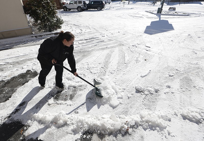
Arkansas roads are improving across the state after winter weather impacted travel on Sunday and Monday, the Arkansas Department of Transportation said.
“Roads in Central Arkansas are looking pretty good this morning, especially major roads,” Dave Parker, a spokesman for the department said Tuesday. “We expect to see some melting thanks to the sunshine, even though temperatures will still be below freezing today. Sunshine is our ally.”
The main concern in the Little Rock Metro area is ice patches and snow buildup on off and ramps, Parker said.
“We plan to make a dent in secondary roads today and to handle pushing the snow buildup farther off the shoulders because we don’t want the snow to melt into water that gets onto the roads and then it refreezes as ice overnight,” he said.
He said the roads in Northwest Arkansas are even better, especially the interstates and highways.
“If the Little Rock area roads are like a six [on a scale of one to 10], then the roads up there are an eight or a nine,” Parker said.
Southeast portions of the state got more snow on Monday, so the roads are not as good down there, he said.
As of just after 9 a.m. on Tuesday, the IDriveArkansas online map showed that much of the highways and interstate roads in the southern half of the state were covered in ice. Many roads in Central Arkansas were shown to be covered in snow and ice patches.
“I would say the roads down there have slightly worse conditions because they got the brunt of this winter weather, which is pretty unusual,” he said.
Parker said that Arkansans should still plan to drive slowly.
“It is still below freezing and there could still be patches of ice. I don’t want people to see the sunshine and think that it is a lovely day and they can go their usual speed,” he said.
He said drivers should consider giving extra braking distancing, especially near on and off ramps.
“We plan to make a lot of headway today, but drivers should be just a little more patient and give themselves a bit more time when traveling,” he said.
The department’s crews have been working 12-hour shifts, with the day crew handling a lot of work on the roads due to the increased visibility, Parker said. The night crews have worked on maintaining that work as well as repairing equipment to get it ready for the next shift.
“Dealing with snow and winter is part of our job, but dealing with these low temperatures is hard for anyone. So, hats off to those guys, they’re the real heroes in this,” Parker said.
Parker also said the department is keeping an eye on another system on Thursday that could possibly bring more wintry precipitation into the state.
“It’s only mid-January, we’ve still got a whole winter to go,” he said.
Sherwood officials said its main thoroughfares are passable, but side streets remain questionable.
And the city's Public Works crews are working to make side streets more passable.
2:38 P.M. -- KROGER PUTS LIMIT ON MILK
Kroger stores on Tuesday posted signs to alert customers of a temporary limit on milk products, to three per day per household.
2:30 P.M. -- LESS THAN 200 WITHOUT POWER
Entergy and the Electric Cooperatives of Arkansas outage maps showed that less than 200 Arkansans were without power as of Tuesday afternoon.
Just over 70 customers were without power just after 2 p.m. on Tuesday, according to Entergy’s online outage map.
Saline County had the most customers without power, showing 30 customers still. The next highest number of customers without power was 13 in Ashley County, the map showed.
Matt Ramsey, a spokesman for the utility, said Entergy handled this winter weather event very well.
The peak number of outages was around 2,500 at 8 p.m. on Sunday, Ramsey said. Most of the outages were in the central portions of the state, including Conway, Little Rock and Pine Bluff.
“I think the preventative measures we take with vegetation and line maintenance year round really showed this week,” Ramsey said Tuesday afternoon.
He also said Entergy reported no major damage to equipment.
“Most of what we saw were trees falling on power lines and at one point a car hit a pole while traveling in poor driving conditions,” Ramsey said. “And those are things you can’t always prepare for in advance.”
He said Entergy is prepared for the next Arctic air mass.
“Just like we were ready for this storm, we’re ready and prepared for more cold,” Ramsey said.
He said that Arkansas should consider staying inside, layering up and trying to keep the thermostat set to 68 degrees in order to keep their energy bill down.
Just after 2:15 p.m., the Electric Cooperatives of Arkansas outage map showed that less than 70 people were without power.
Carrol and Perry County both had over 30 customers still without power.
Information for this story was contributed by Daniel McFadin of the Arkansas Democrat-Gazette.