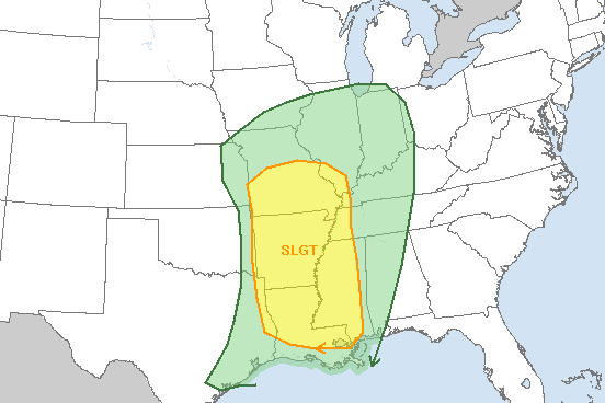
LITTLE ROCK — Forecasters say the entire state is at a slight risk for severe weather as storms move through overnight Wednesday into Thursday.
Northwest Arkansas, meanwhile, could also see some snow flurries, though no accumulation is expected.
John Robinson, senior warning coordination meteorologist for the National Weather Service in North Little Rock, said severe weather chances will start to develop in western Arkansas early Wednesday evening.
The chances will then continue as the storms move across the rest of the state through the night.
"Damaging winds will be the primary severe weather threat," Robinson said in an e-mail. "There could be some large hail, mainly in western Arkansas this evening. A couple of tornadoes are not out of the question, mainly from north central into central Arkansas."
The storms are expected to be out of the state before dawn Thursday, Robinson said.
The light Northwest Arkansas snowfall is possible roughly from 3 a.m. to 11 a.m., Robinson said.