It was the third-coldest year in Arkansas history through November and, while temperatures climbed above normal this month, forecasters said that after they compile climate data at the end of the year, 2014 will still be considered one of the top five coldest years on record.
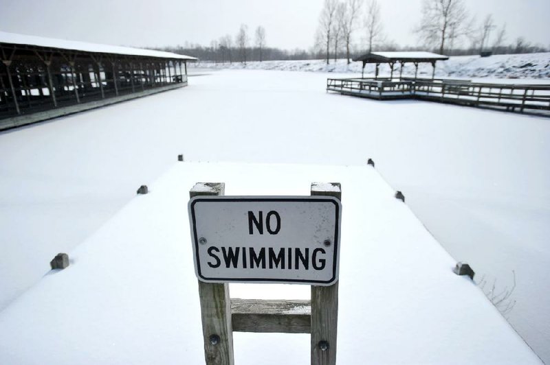
Throughout the year, cold Canadian air kept returning to Arkansas. Snow stayed on the ground for several days in February, and the cold air created less tornadic activity across the state during the spring. It also created more potential for snowfall as the year comes to an end.
"We saw the same pattern all year long," said National Weather Service meteorologist John Lewis of North Little Rock. "We'd get continual shots of cool air."
Through November, the statewide average temperature in Arkansas was 60 degrees, which was 2.1 degrees below normal for the first 11 months of the year.
Fayetteville had the lowest average of 56.6 degrees from January through November, 2.1 degrees below average for the Washington County city.
Little Rock averaged 62.4 degrees during that period, which was 1.9 degrees below normal.
Most of the eastern half of the United States recorded record low temperatures, as well, said Dan Kottlowski, an Accu-Weather meteorologist at Pennsylvania State University.
"We saw constant surges of cold air," he said. "And it looks like we'll see more. We will see early seasonal outbreaks of more cold air from the west to the east for at least the next three months."
The colder air held back formation of storms in the state early this year. There were no tornadoes reported during the first three months of the year.
However, on April 27, warm, moist air collided with the cooler air and created an unstable atmosphere.
A large tornado formed west of Little Rock and carved a path of destruction from the Paron area through Mayflower and Vilonia and on to El Paso before ending. The weather service rated the tornado an EF4, meaning it had winds between 166 mph and 200 mph.
It was the single deadliest tornado in the state since May 15, 1968, when a twister killed 35 people in Jonesboro.
Eight months later, evidence of the storm's wrath in the area is still visible.
"It'll be a long time coming back," said Amanda Norwood, an assistant to the mayor of Vilonia. "We are still in the process of rebuilding. It doesn't happen overnight. It's a long process."
The state reported 20 tornadoes this year, compared with 34 last year.
In all, at least 23 people lost their lives in weather-related accidents in 2014, the National Weather Service reported. In addition to the 16 April 27 storm deaths, someone died in a tornado in Little River County; four died in high winds that were not rated as tornadoes; and two died by lightning.
Through the summer, the weather remained cool.
Temperatures climbed to only 83 degrees in Little Rock on July 4, the lowest high recorded for that day since July 4, 1976. On July 17, most cities in the state didn't see the mercury climb above the 60-degree mark.
"You don't expect cold air intrusions this far south all year," said National Weather Service meteorologist Marty Trexler of North Little Rock. "It certainly happened this year."
During June, July and August this year, Fort Smith recorded 15 days of 95-degree or higher temperatures. On average, since 2000, the city has 37 days that top the 95-degree mark. Harrison recorded only two days of 95 degrees or above; on average, the Boone County city reports 14 days of such high temperatures.
It appears that the first three months of 2015 will have temperatures similar to this year's, Trexler said.
The formation of a weak El Nino system, a warming of the Pacific Ocean off the coast of South America, should result in the weather in Arkansas being similar to what it was this year, Trexler said.
"It looks like we'll see a progressive pattern like this year," he said. "We may see rain, but the systems move in so fast, they aren't here long enough to grab any real moisture."
The state could develop some drought conditions because of the lack of moisture. According to the U.S. Drought Mitigation Center at the University of Nebraska at Lincoln, 50 percent of Arkansas is now considered to be abnormally dry, a classification given to an area that is 1-2 inches deficient in rainfall over a 30-day period.
"It doesn't look like there are any big systems coming anytime soon," Trexler said. "It sure looks like we will carry this pattern into next year."
SundayMonday on 12/28/2014