Thunderstorms should begin developing in the state in the early to mid-afternoon on Friday, especially in western Arkansas, the National Weather Service said.
John Robinson, warning coordination meteorologist with the National Weather Service in Little Rock, said more severe thunderstorm warnings will be issued Friday than Thursday.
The National Weather Service said two severe thunderstorm warnings were issued on Thursday.
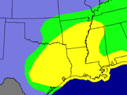
The northern part of the state will be at risk of large hail with a small chance of damaging winds, while the southern part of the state has a chance of large hail, damaging winds and an isolated tornado or two, Robinson said.
The greatest chance of severe weather will likely be over the southern third of the state, while the Arkansas-Louisiana-Texas area will have the greatest chance for a tornado on Friday.
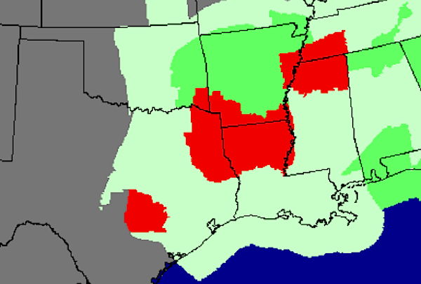
The severe weather threat should exit southeast Arkansas this evening, forecasters said.
Rainfall should average 1/2 inch to 1 1/2 inches Friday, but could vary by location, Robinson said.