A storm system rolling through the region from Texas could bring another round of severe weather Monday morning to Little Rock and southwest Arkansas, forecasters said.
Isolated thunderstorms could begin Sunday night before the primary threat, hail and damaging winds, occurs Monday morning and lasts into the afternoon, National Weather Service meteorologist Michael Brown said.
"The timing of this system is going to be important because if it happens in the afternoon, you could get low-level instability," he said.
Heavy rain will fall north of the Interstate 30 corridor, but Brown said it might not be severe in nature.
Forecasters said the storm is likely to reduce the wildfire threat that exists across a large portion of the state.
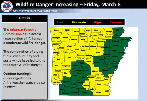
With humidity values hovering around 20 percent combined with strong winds of up to 15 mph, the Arkansas Forestry Commission has again placed much of Arkansas under a moderate risk for wildfires.
The fire weather watch will be in effect Friday afternoon before southerly winds from the Gulf bring moisture back into the air Saturday, Brown said.