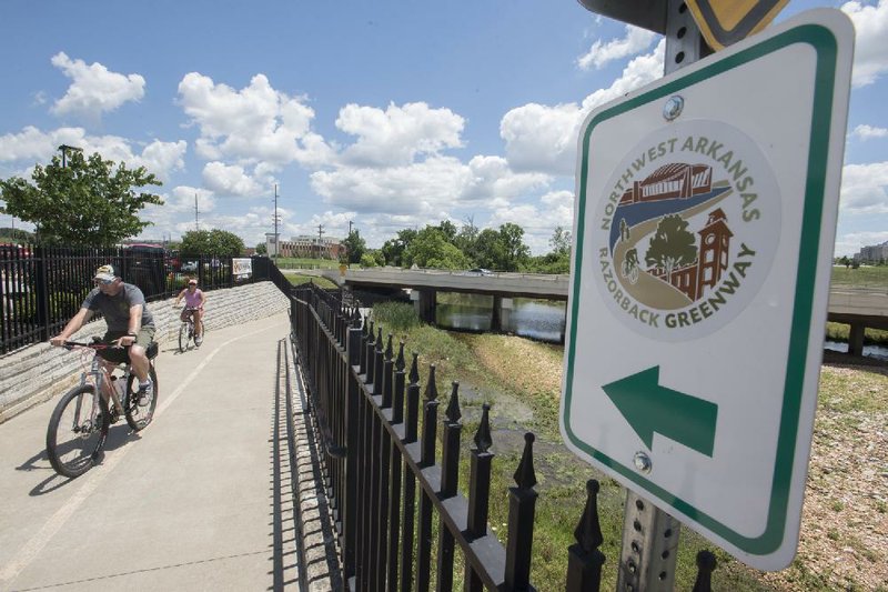
Construction projects and new regional way-finding signs will bring directional clarity to a few confusing sections of the Razorback Regional Greenway, officials said.
The 36-mile trail runs through several cities from Fayetteville to Bella Vista.
Most of the greenway is an independent paved trail, but some sections are connected by sidewalk or road, which can confuse trail users on which direction to go.
Fayetteville resident Star VanAllen called the Bentonville Police Department for assistance after taking a wrong turn while biking in Rogers the same day as the Square-to-Square Ride in May. His wrong turn placed him nearly 2 miles east of where the greenway crosses Southeast 14th Street in Bentonville.
VanAllen doesn't have a car and uses the Fayetteville trails to get around in the city. It was his first time to ride the greenway from square to square. He said the signs on the greenway were inadequate for someone unfamiliar with the trail.
The Northwest Arkansas Regional Planning Commission is working to place several different types of signs along the entire length of the greenway to provide more directional clarity and information about the areas it passes through.
Some signs will be markings on the trail's pavement while others will be metal signs, said Elizabeth Bowen, regional planner with the commission.
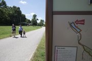
Different types of signs will give different types of information, such as street names, mile markers, directional arrows with distances to destinations within cities, and what kind of amenities are at nearby trail heads, she said.
There will be directional arrows and multiple signs in areas where the greenway's path is unclear, Bowen said.
"They'll be kind of like bread crumbs," she said. There may be three signs in a row that turn users in another direction to keep them on the greenway rather than continuing on a separate city trail, she said.
"You might have three in a row where it takes you off of one direction of a trail and turns you to go in another direction to keep you on the greenway verses going off on a separate city trail," she said.
The signs cost $248,068 and are being paid for with leftover money from the Walton Family Foundation's contribution for the greenway construction, Bowen said.
The pavement markings are scheduled to be applied within the next six weeks. The metal signs are to begin going up in August. All signs are expected be in place by the end of September.
"We're hoping that this will be the finishing of all signage that's needed for the greenway," she said. "That's the goal."
One of the most confusing sections of the greenway is in Rogers, where it passes underneath West New Hope Road.
The greenway turns right, loops around Einstein Bros. Bagels and continues on a sidewalk heading west under Interstate 49. Turtle Creek Trail, a Rogers city trail, continues north when the greenway turns right.
Several participants in the Square-to-Square Ride in May noted in a post-ride survey that that section of the trail was confusing. A few said they continued on the wrong trail for a few miles before realizing their mistake.
It was the second Square-to-Square Ride that the Bentonville and Fayetteville Parks and Recreation departments organized since the greenway was dedicated May 2, 2015. The first ride, which guided cyclists from the Bentonville square to the Fayetteville square, was last fall.
The ride last month started in Fayetteville and concluded in Bentonville.
A $1.2 million project is underway that will include a bridge that will allow greenway users to cross Blossom Way Creek south of Olive Garden instead of having to loop around Einstein Bros. Bagels, said Nathan Becknell, Rogers project engineer. The city is paying for the project with federal grant money.
Another $1.2 million trail project is under construction to provide an alternate route west of I-49. The new route will run behind South 52nd Street and go through the Village on the Creeks shopping center.
The greenway currently uses the sidewalk that runs along South 52nd Street. A woman running on the sidewalk in front of the shopping center died in February after being struck by a vehicle. The alternate route will separate trail users and motorists.
Both projects should be wrapping up the end of the year, Becknell said.
Becknell said he hasn't heard of any trail users getting so lost in Rogers that they've had to contact the police for help, but "we definitely have heard from people that it can be complicated on how to get around," he said.
Bentonville Parks and Recreation Director David Wright said he's also heard that people have gotten lost or been confused on which way the greenway goes in Bentonville, even though there are signs at every turn to tell people which direction to follow.
Cyclists may miss the signs if they're looking down or around while approaching them, Wright said.
Bentonville recently accepted a $1.65 million Walton Family Foundation grant to build pedestrian tunnels at the intersection of Southeast Eighth and Southeast J streets. The city also applied for grants to build a pedestrian tunnel under Southeast 14th Street between Southeast J and O streets.
"The tunnels that we're adding for safety and convenience are also going to eliminate any type of confusion on 'where am I supposed to go,'" Wright said.
There haven't been many reports of trail users getting lost in Fayetteville, said Matt Mihalevich, trail coordinator.
"We've really been intentional about designing our trails to be somewhat intuitive on which way it goes," he said, adding that a center stripe and consistent width help.
The one spot that may be confusing is near Lake Fayetteville as the greenway comes off Spillway Bridge. Trail users have to be intentional about turning left there, he said. There is a sign to help direct.
Northwest Arkansas' four largest cities each have bike teams in their police departments.
It's difficult to track how many calls come from people on the trails since they could be labeled in various categories, Bentonville Police Chief Jon Simpson said.
"They're very few and far between," he said of the number of calls.
The Bentonville bike team has eight members, one specifically patrolling trails and downtown.
The protocol for a call from a trail would be similar to a motorist on the street, Simpson said. The dispatcher would ask the caller to identify trail markers, landmarks, what they see above the treeline or other distinguishing features.
VanAllen said it took more than an hour for the police to identify his location and pick him up.
He wandered through Rogers city trails until he emerged at the Sam's Club in Bentonville, which borders Rogers city limits.
"I knew I was going to get rescued," he said. "I had that confidence, but it was stressful."
Metro on 06/06/2016