GUADALUPE PEAK, Texas -- Be nice to people on the way up because you'll meet them on the way down. So it goes for Guadalupe Peak, the highest point in Texas.
Located in Guadalupe Mountains National Park, about 800 miles from Little Rock, the strenuous hike allows for a view of the Chihuahuan Desert as far as the eye can see. The journey also graces the hiker with the camaraderie of sharing a journey that takes six to eight hours from bottom to top and back again.
Carlsbad, N.M., is the staging point for a hike up Guadalupe Peak in Texas, that state’s highest point.
There are a number of new hotels, and many of their guests are the oil-field hands who work on the numerous rigs and pumps here. Carlsbad, located in southeastern New Mexico, is in the Permian Basin that mostly stretches across the vast emptiness of West Texas.
Boutique Air serves the local airport. An alternative would be to fly into El Paso, 168 miles southwest, and rent a car.
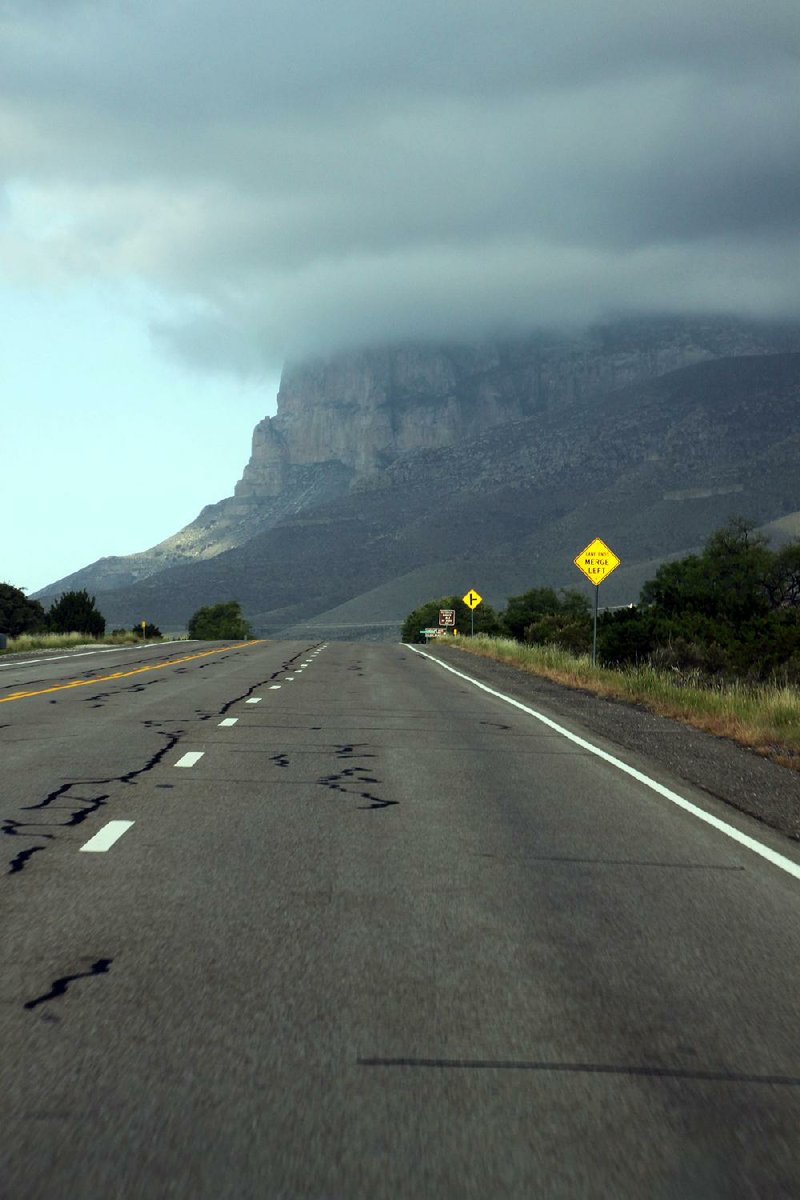
Driving means about 800 miles from Little Rock to Guadalupe Mountains National Park, about 50 miles south of Carlsbad.
Travelers can get off the beaten path — Interstate 20 — in Big Spring, Texas. Carlsbad is 175 miles away, and there’s not much in between except Andrews, Texas; Eunice, N.M.; and vast landscapes of flat, arid country. Also many oil pumps and derricks. Roadrunners provide brief diversions.
Carlsbad is a city of about 27,000 people, situated on the Pecos River. South of town is Carlsbad Caverns National Park. Our small group went to the caverns over the long Fourth of July weekend — as did thousands of our closest friends. The wait to take the elevators up from the caverns to the visitors center was 1 hour and 20 minutes.
Carlsbad’s newspaper, the Current-Argus, reports the number of visitors to the caverns in 2016 to have been 466,773.
Guadalupe Mountains National Park is much-less visited — about 145,000 a year.
Expect sunshine in Carlsbad. The city averages 13.43 inches of rain a year. The average high temperature in August is 93 degrees.
Info: nps.gov/gumo/index.…, cityofcarlsbadnm.com
— Frank Fellone
More about the top later. First, the people.
There was the proud Texan, lugging a state flag to the top. A hike to the highest point in Texas, he said with a grin, had to be celebrated with a photo that included the flag.
There was the hiker at the top who offered water to anyone who needed it. Many times he'd hiked to the peak, he said, and always carried water for those who didn't pack enough.
There was the young woman with hiking poles who blazed her way to the top faster than seemed possible, and who made the descent at a swift jog.
There were the two young women we met on the way up, on the way down and at the bottom, and who cheerfully engaged in conversation at each point.
And there was the high-pointer, a man who said Guadalupe Peak was his 33rd state highest peak. Not likely to be included, his companion said, was Alaska's Mount McKinley, the highest point in North America at 20,320 feet.
Guadalupe Peak is 8,749 feet above sea level. Arkansas' highest peak is Mount Magazine, at 2,753 feet.
There's also a difference in humidity. Our climb in Texas was done in 10 percent humidity; Mount Magazine's humidity on a similar day in July was 53 percent.
Yes, it's a dry heat out there in the Chihuahuan Desert. Call it sneaky hot. El Paso, 168 miles to the southwest, and Carlsbad, 50 miles to the north, each topped out at 101 degrees during our trip. It's worth noting, sadly, that two people perished in the park in June. The whole park is 86,416 aces, and was established in 1972.
The National Park Service recommends carrying plenty of water, taking frequent breaks and avoiding overexposure to the sun. A hat and sunscreen lotion are essential. Our hike taught us to carry at least a gallon of water per person, lunch and a couple of snacks. Six to eight hours of hiking, uphill and downhill in the desert sun, requires sustenance. The trek climbs about 2,900 feet over the course of the roughly 8.5-mile hike.
Afternoon thunderstorms occur in the summer months. High ridges, the park service says, are especially susceptible to lightning strikes.
Boots, broken in with good ankle support and firm soles, are a smart idea.
Our hike and the hikes of the roughly 100 others we encountered that day, began at the Pine Springs campground. This was cheap fun -- free for the senior citizen with a lifetime national parks pass; $5 for the much younger companion. At 7:30 a.m., the temperature was cool at 72 degrees. A magnificent cloud hung over the top of the mountain. On the hike, three people who stayed overnight at Guadalupe Peak campground said they were in fog at 6:30 a.m.
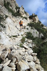
The trail breaks into four parts. A graph on the park's website shows the elevation to be consistently gradual from bottom to top, but the first and last segments are the most strenuous. The first segment, from the trailhead to the stock trail, is roughly a mile of stepping up -- and stepping up, and stepping up -- via a series of switchbacks. Plenty of huffing and puffing here. From the stock trail to "Around the Bend" and up to the campground is easier on the knees. And even cool, as it winds through the forested north-facing slope.
But that last mile, from the campground to the peak, is taxing. With three miles of climbing already done, legs and lungs must go up rocks, rocks and more rocks.
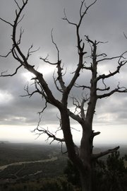
On the way, the views are spectacular. To the north is the mountain range. To the south is the desert. Straight up, once the cloud cover dissipated, is a sky of brilliant blue. At ground level, a variety of plants grow, including the Texas madrone tree, known for its peeling orange bark.
Grinding on through the final mile, step after step after step, the goal gradually comes into view, and then is achieved.
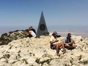
A 360-degree view of West Texas emerges. The sight is brown and gray, and goes on to the faraway edge of the earth.
A U.S. Postal Service marker is implanted at the peak. An old ammunition box holds a green notebook for the weary traveler to write his name and remark on what he sees around him.
We spent about 30 minutes at the peak, eating, drinking and chatting with the others there. Amazingly, there was cellphone service. How cool was it to call home and ask: Can you guess where we are?
Gravity was on our side for the descent, but it would be a mistake to think the legwork was easy. Loose rocks made footing slippery in places. Tired hikers had to be especially careful at the several places where a slip would have meant a precipitous fall down a rocky cliff.
Six hours after the start, we made the finish, sat down and had a second lunch. Plus more water. And the swapping of congratulations with the two young female hikers.
After a respectable rest, it was back to Carlsbad, the hotel pool and a couple of cold ones in the company of the friendly folks at Milton's Brewery.
Travel on 08/27/2017