A storm system that entered the state Thursday and is expected to leave this evening will dump up to 2 inches of rain in southern and northern Arkansas, National Weather Service meteorologists forecast, but it shouldn't hinder the receding of the White River.
"We're not too shook up about the amount of rain coming," Prairie County Office of Emergency Management coordinator Philip Norman said. "A little bit of rain won't bother the river."
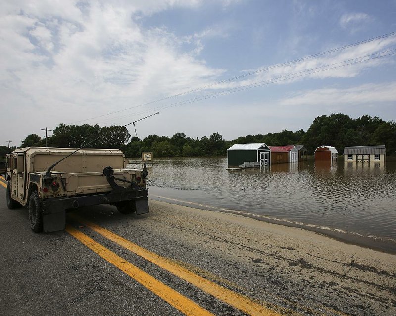
The flooded White River should crest at 34.5 feet in Clarendon on Saturday afternoon, which is about a foot below what the National Weather Service originally predicted. Upstream, the river has already begun receding.
In Des Arc, where officials were concerned whether levees could hold back floodwater, the White River has dropped nearly a foot since cresting Tuesday at 35.5 feet.
The White River began flooding earlier this week after heavy rains soaked most of northern Arkansas on April 29 and April 30. Six to 8 inches of rain fell into the upper White River basin and made its way south.
In southern Missouri, 10 inches of rain caused the Current River to reach record-high marks in Van Buren, Mo., and Doniphan, Mo., and that water poured into the Black River in Randolph County. The Black River in Pocahontas reached a record high May 2 and nine sections of levee protecting the eastern part of the city broke when water topped them, flooding more than 100 homes.
At least nine people in Arkansas died in the storms.
Water from the Black River rushed south and into Lawrence County, forcing the closures of U.S. 67 and U.S. 63. The water eventually made its way back into the Black River south of Clover Bend and headed downstream.
Both highways have since reopened.
The Black River empties into the White River just north of Jacksonport.
"When you cross the White River bridge [on U.S. 79], there's water as far as you can see," said Nancy Hornsby, a nurse practitioner at Baptist Health Family Clinic in Clarendon. "There's water on both sides of the road."
Norman said many Prairie County homes along the White River are flooded, but the lowering of the White River's crest means numerous houses will be spared flooding.
"It's going to take a little time to get this water out of the county," Norman said. "More and more we should know what our damages are as the water gets out."
Federal Emergency Management Agency officials surveyed damage in northwest and central Arkansas on Wednesday and Thursday but were still unable to get to some areas because of road damage and high water, said Melody Daniel, a spokesman for the state Department of Emergency Management.
"It's heartbreaking to see the damage," Daniel said. "We have some people who had 5 inches of water in their home briefly during flash flooding, and others still have 4 feet of water."
She said assessments will continue next week, and she hopes officials can begin surveying damage in eastern Arkansas.
Randolph County Judge David Jansen said he has yet to get a grasp on how bad his county was hit by the flooded Black and Current rivers.
"We can't get into a lot of areas," he said. "The water is amazing. We're doing the best we can. As soon as it gets back down, we're going to go in as quickly as we can."
He said his road foreman told him that a 3-mile section of county road east of Pocahontas was washed out when flash flooding occurred early last week.
Emergency management officials could begin surveying Randolph County by the middle of next week, Daniel said.
"Bring them on," Jansen said of the federal inspectors. "My folks are ready. Our citizens need to see those people and get some help."
Jansen said he also inspected sections of the Running Water Levee System, an 8-mile earthen berm built to protect businesses and homes in east Pocahontas. Three major sections, one at least 35 feet deep, broke from the levee, and six other sections gave way.
On Thursday, thunder rumbled across much of Arkansas as storms moved in.
Two lines of "bowing clusters" of thunderstorms were expected to form in the northeastern and southern parts of the state Thursday evening. The term "bowing" refers to the way the storms look on National Weather Service radars.
Meteorologist John Lewis of the National Weather Service in North Little Rock said most of the state will see rainfall amounts of between a half inch to an inch. Northeast and southern Arkansas could receive up to 2 inches of rain before the storms head east of the state by this afternoon.
"It won't be enough to affect the rivers," Lewis said. "We've done projections of rainfall in the river basins, and it doesn't appear it will affect them."
State Desk on 05/12/2017