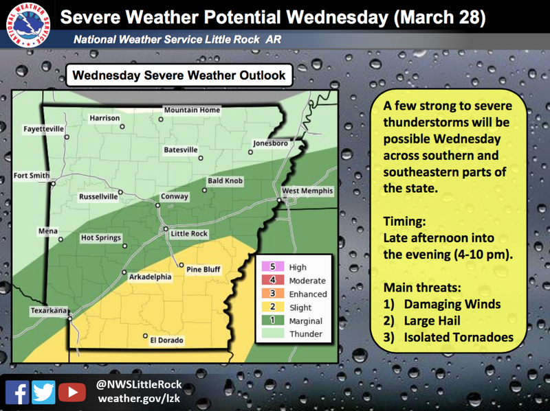
Southern Arkansas is under a slight risk for severe weather on Wednesday, the National Weather Service in North Little Rock said.
The primary threats in areas like Pine Bluff and El Dorado will be damaging winds, large hail and isolated tornadoes, according to the latest outlook.
Storms are set to enter that region by late afternoon and into the evening hours.
Up to 3 more inches of additional rain is expected in portions of southeast Arkansas as a front slowly exits the state. Other areas of the state will likely see up to 2 inches.
Precipitation will be most widespread in the southeast half of Arkansas, though showers are possible elsewhere in the state, forecasters said.
“Given a nearly saturated ground, water will have nowhere to go and runoff rates will be high,” the weather service cautioned. “This will elevate the potential of flooding.”
Portions of the White, Black, Cache and Ouachita rivers will be impacted, forecasters said.
Two to four inches of rain fell in Northwest Arkansas on Tuesday. In the remainder of the state’s north and west as well as central Arkansas, one to two inches of rain was recorded.
Less than an inch fell elsewhere in the state, according to the latest data.